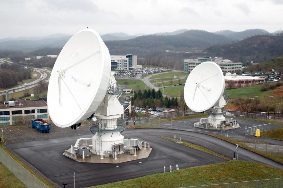
Fairmont’s NOAA Satellite Dishes
VP of GST visits Future Global Crisis class
For students and residents traveling north on I-79, three giant satellite dishes serve as a landmark for home. Situated on a hill close to the interstate, a bend in the road brings them directly into view. They are impossible to miss. While most people speculate that they are part of some government installation (they are right), most don’t know the purpose of these satellites or who runs them. For Dr. Paul Edward’s “Future Global Crisis” class, those questions, and more, were answered by Mr. Norman Gundersen, Vice President and General Manager of Global Science and Technology, Inc. (GST).
The satellite dishes are located at the Consolidated Backup Facility, a joint endeavor between NASA / NOAA, and is part of the Geostationary Operational Environmental Satellite system (GOES). The purpose of this system is to collect data on the Earth’s climate and weather. Three satellites are in geosynchronous orbit, each tasked with a particular geographic coverage area: east coast, west coast, and everything else in between. Each dish is assigned to collect the stream of data beamed back from one of the satellites. This is where GST and Mr. Gundersen come in.
GST designed and monitors the computer system that handles all of the raw data coming in from the satellites. The system here in Fairmont is capable of handling 38 petabytes of data (that’s 38,000 terabytes) and plans to expand in the future to an excess of 100 petabytes. It is used by both NOAA and NASA to predict weather and to study climatological data. GST creates the user interface needed to access the data and handles the traffic between the satellites, the facility, and other government or private agencies accessing the information.
GST also develops their own programs and provides services to non-government entities. It provides major IT support & functionality for the state of West Virginia and plans to improve preparedness for natural emergencies by developing better, more localized weather predictions, including flooding and rainfall, for West Virginia.
Mr. Gundersen primarily took questions from students and used those to direct where the conversation would go. Questions ranged from inquiries as to the accuracy of the data (more accurate than you need), to questions about climate change, to how involved NOAA is with the various intelligence agencies (they are, but it’s a secret). Students seemed to enjoy the interaction and many different aspects of the facility, as well as the various programs running there, were discussed.


Richard Grigg // Mar 22, 2019 at 10:22 am
The satellite dishes are also used for NOAA’s polar orbiting satellites – the JPSS series. More information available at these NOAA websites:
https://www.jpss.noaa.gov/index.html
and
https://www.nesdis.noaa.gov/JPSS-1